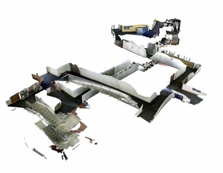
Professor John Leonard and his colleagues at the National University of Ireland (NUI) at Maynooth have developed a new mapping algorithm that creates highly-detailed 3-D maps.
“The technique solves a major problem in the robotic mapping community that’s known as either “loop closure” or “drift”: As a camera pans across a room or travels down a corridor, it invariably introduces slight errors in the estimated path taken. A doorway may shift a bit to the right, or a wall may appear slightly taller than it is. Over relatively long distances, these errors can compound, resulting in a disjointed map, with walls and stairways that don’t exactly line up,” wrote Jennifer Chu in an article in MIT News.
“In contrast, the new mapping technique determines how to connect a map by tracking a camera’s pose, or position in space, throughout its route. When a camera returns to a place where it’s already been, the algorithm determines which points within the 3-D map to adjust, based on the camera’s previous poses.”
“In contrast, the new mapping technique determines how to connect a map by tracking a camera’s pose, or position in space, throughout its route. When a camera returns to a place where it’s already been, the algorithm determines which points within the 3-D map to adjust, based on the camera’s previous poses.”
The new technique could prove useful for everything from guiding robots in search and rescue or disaster relief operations to creating a 3-D map that allows potential students to explore the MIT campus.
Read the full article here: http://web.mit.edu/newsoffice/2013/3d-mapping-in-real-time-without-the-drift-0828.html.
